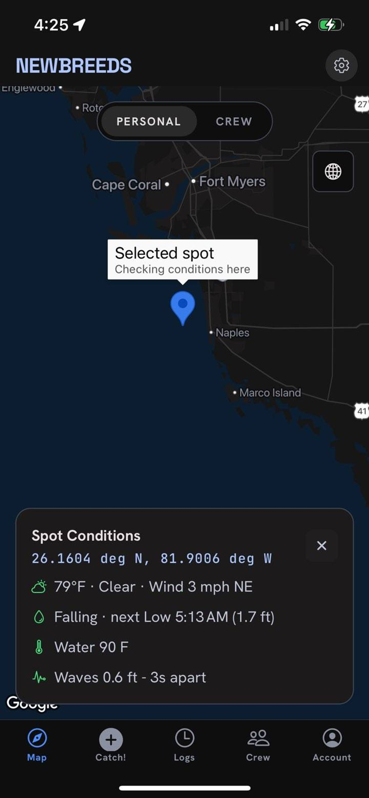
Exact GPS
The spot is pinned precisely. Your honey holes map themselves — private to you unless you share.
on-deviceThe Newbreed Angler Network
Tap once when you land a fish. Newbreeds drops the GPS pin and captures the weather, tide, water temp, barometric pressure and moon at that exact moment. Logging is free, forever — upgrade to turn your history into insights, predictions, Reef Hotspots and a private crew.
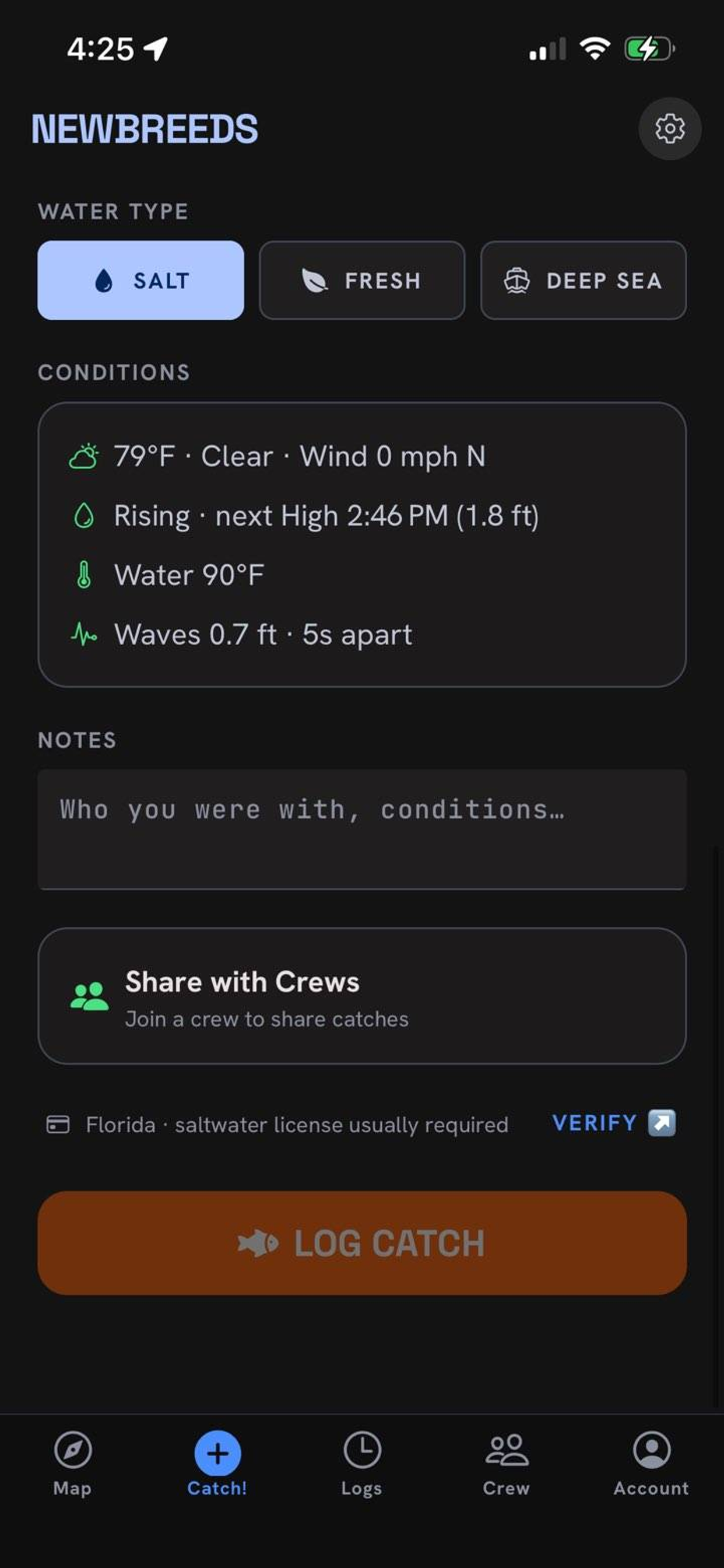
Water type
Conditions
📍 Florida · saltwater license usually required VERIFY ↗
Zero typing · always free
Every catch is logged with the exact conditions that produced it — pulled live from public marine data the moment you tap. This is the data that later powers your insights and predictions, and it's captured on the free plan.
The spot is pinned precisely. Your honey holes map themselves — private to you unless you share.
on-deviceAir temp, sky and wind read from the nearest station the second you log.
US National Weather ServiceRising or falling, next high/low, tide range and spring / neap — how much water is actually moving. Skipped on freshwater.
NOAA CO-OPSSea-surface temperature and wave height for salt and deep-sea catches.
Open-Meteo MarinePressure and its 3-hour trend — rising, falling or steady. The single biggest tell for a bite, captured automatically.
the data moatMoon phase and illumination for every catch, so your best lunar windows surface over time.
computed on-deviceCross-references your state, species and length into "keeper or release," with a link to the official agency to verify.
advisory · FWC linkSnap or pick a picture. It's re-encoded to strip EXIF and GPS before anything leaves your phone.
privacy by defaultA look inside

Premium
Once you're subscribed, Newbreeds rolls your whole history into patterns you can act on — computed on your own catches, updated instantly, and it works offline.
Premium
Newbreeds pulls the National Weather Service 7-day forecast and scores each day against the conditions your catches love — so you know when to make the run.
Conditions and predictions are estimates for convenience — always confirm current regulations and conditions before you head out. Not for navigation or safety-of-life decisions.
Know the water
Newbreeds layers public marine data onto your map so you can find structure and fish it safely.
Florida's artificial reefs with estimated bite windows. Tap a nearby reef while logging to tag its structure and depth.
FWC Artificial Reef dataActive small-craft, gale, storm, high-surf and rip-current alerts at your spot, most-severe first.
NWS marineThe worst recent HAB (Karenia brevis) sample near a spot, in FWC's cells/L categories.
FWC HABAn optional NOAA ENC chart overlay for reference on the map.
NOAA Office of Coast Survey🧭 Safety: reef coordinates are reported, approximate, and many are unverified — not a navigation aid. Use proper nautical charts and navigate safely. Bite windows are estimates, not guarantees.
Premium · invite-only
Create a crew, share an access code, and the people you trust appear on one shared map. What you log with "Share with Crew" shows up for everyone, in real time.
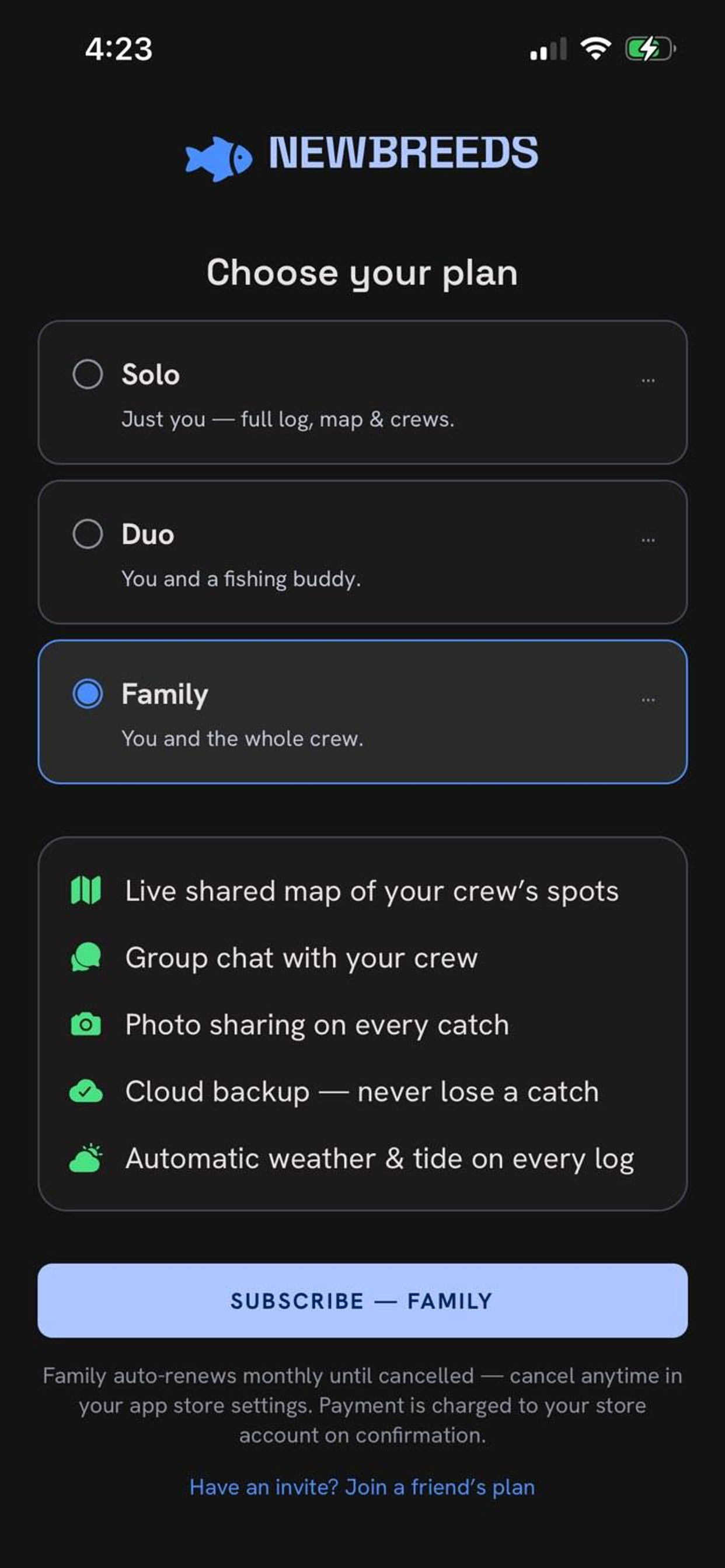
The freemium line
One subscription, shared seats
Premium comes in three tiers — the difference is how many seats ride your plan. Duo and Family share their premium with a buddy (or the whole crew), no separate sign-up. Auto-renews monthly; manage or cancel anytime in your app store.
1 seat
See price in app
Just you — full log, map & crews.
Get Solo2 seats
See price in app
You and a fishing buddy, on one plan.
Get Duo4 seats
See price in app
You and the whole crew.
Get FamilyPrices are set in the App Store and Google Play and shown in the app in your local currency (pricing set for North America). Payment is charged to your store account on confirmation. Logging catches is always free.
Free to start. Coming to the App Store and Google Play.
Designed for Tampa & the Gulf Coast — works anywhere US weather and tide data reach.